WPA Secure — LiDAR perimeter security: site protection and critical infrastructure protection. Perimeter security guesses in 2D, we see in 3D.
SCROLL ↓
ROTATE TO LANDSCAPE · FULL 3D ON DESKTOP
SIA / ISC WEST · 2025NEW PRODUCT SOLUTIONS AWARD
INT'L SECURITY BUYER · 2025PERIMETER SECURITY SOLUTION OF THE YEAR
CAMPUS SAFETY MAGAZINE · 2025BEST WINNER 2025
WHY CODA SPATIAL · SENSOR FUSION · DIGITAL TWIN
A perimeter that doesn’t guess.
Spatial site security with real-time 3D situational awareness — more reliable detection, faster operator decisions and camera automation thanks to sensor fusion and a digital-twin visualisation.
TRUE 3D GEOMETRY
Position, size and trajectory in real space — no guessing from a flat image.
MINIMAL FALSE ALARMS
DeepTection AI filters out animals, weather and environmental noise.
AUTOMATIC PTZ
Cameras turn to the intruder on their own — or with a single click.
PRECISE EVENT LOCATION
Every event has an exact position in the scene, not just a video crop.
CAMERA
POINT CLOUD
CODA SPATIAL
⟷
⟷
SYNCED FOOTAGE FROM A LIVE SITE · T+0.0 s
No animation — the same moment three times: camera image · raw LiDAR data · classification and trajectories in the software. Drag the dividers.Switch the tabs.
HOW IT WORKS · DETECTION PIPELINE
From point cloud to action.
Six steps between a laser pulse and a steered camera. No light needed, no weather issues, no guessing.
STEP 01/06 · CAPTURE
FROM THE CONTROL ROOM · LIVE DEPLOYMENT · EG.D SUBSTATION
What the operator sees.
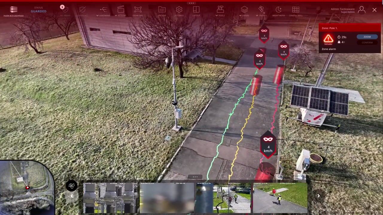
A screen recording from live operation at an EG.D substation — the digital twin of the site, live intruder tracks, zones and alarms exactly as the operator sees them. Uncut.
SCREEN RECORDING · EG.D SUBSTATION · 1:49
One screen, the whole site — positions, speeds, classifications and event history in real time.
LOADING THE 3D MIND MODEL…
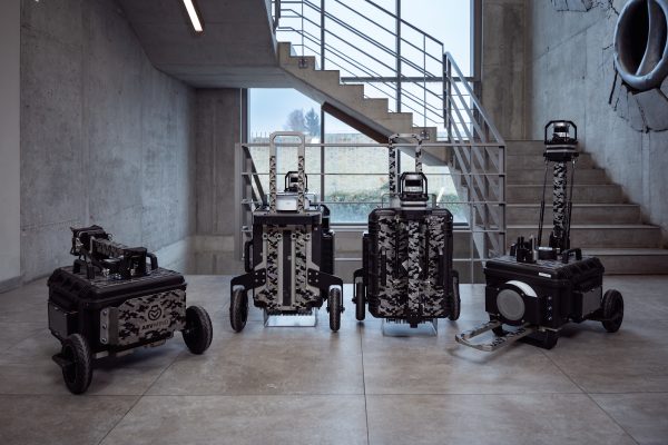
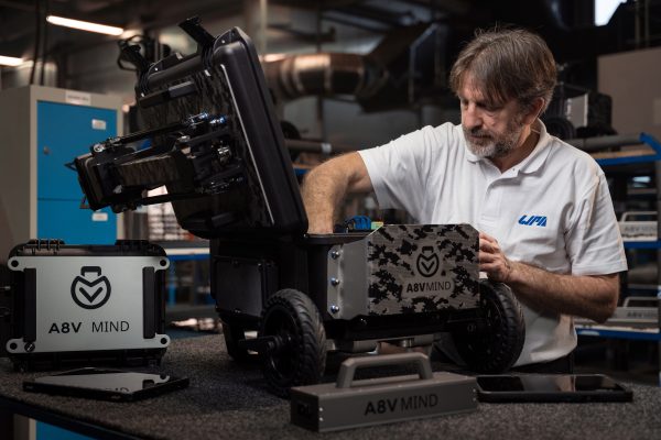
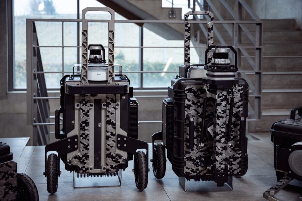
MIND · PORTABLE LiDAR DETECTION UNIT
Unfold it, switch it on, it guards.
LiDAR maps intruders in real time with 2 cm accuracy up to 100 metres. You draw the zones yourself; on alarm the operator sees the number of intruders, exact positions, sizes, speeds and trajectories.
100 mDETECTION RADIUS
31 400 m²COVERAGE · 4+ FOOTBALL PITCHES
360°FIELD OF VIEW
<5 minDEPLOYMENT TIME
4/32 hBATTERY INT. / EXT.
IP54PROTECTION
4G·5G +Wi-FiCONNECTIVITY
−20/+60 °COPERATING TEMPERATURE
BUILT ON CODA SPATIAL · DEVELOPED AND MANUFACTURED IN PILSEN, CZECH REPUBLIC
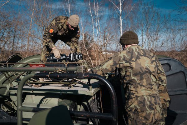
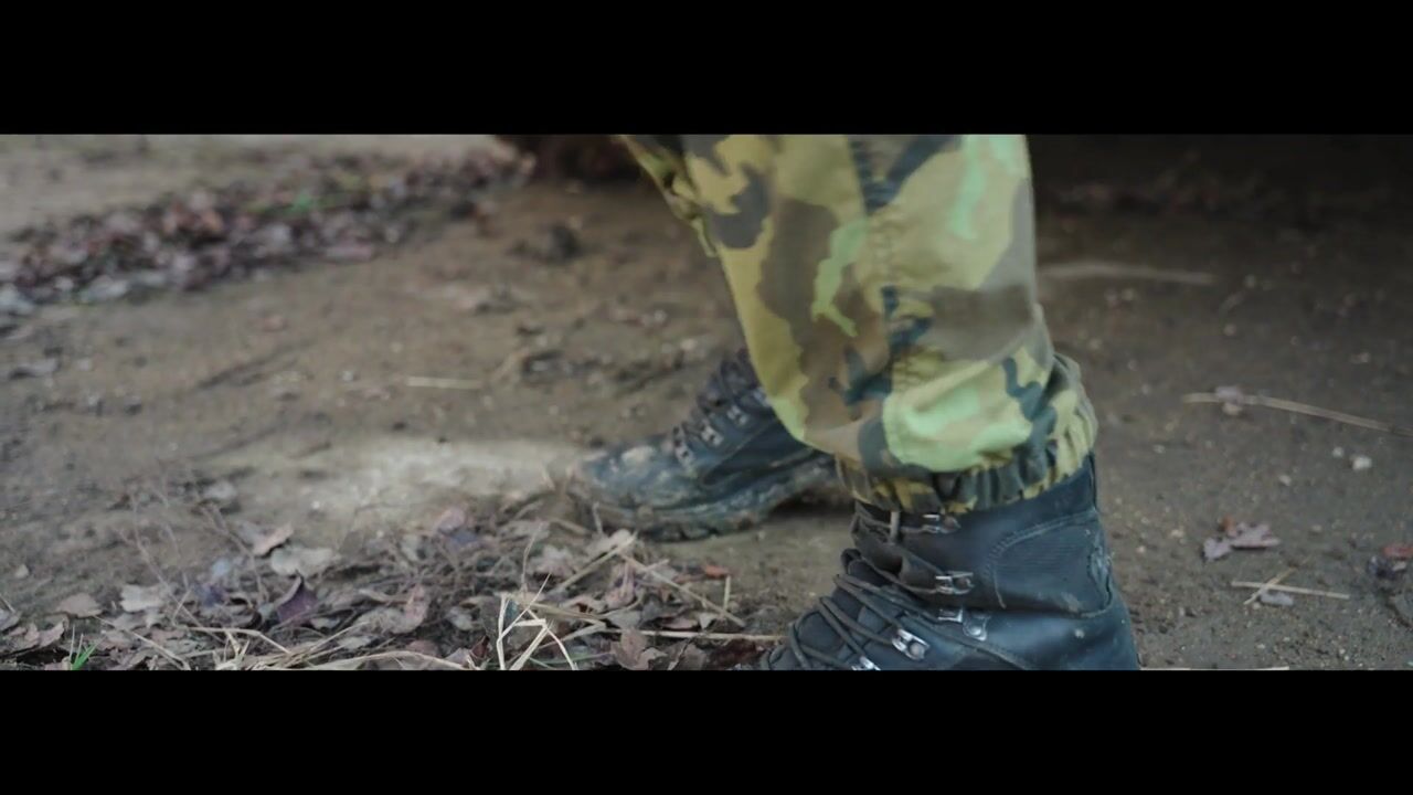
MIND in military use — off the truck bed, unfold, switch on. The unit then guards the area on its own and reports every movement.
FIELD FOOTAGE · MIND · 2:03
The same unit as in the photos above — IP54, −20/+60 °C, battery for up to 32 hours.
BORDER SECURITY · LONG PERIMETER · ONE OPERATOR
Hundreds of cameras. One operator.
A conventional control room on a long border: hundreds of cameras, dozens of operators per shift — and an intrusion still gets through, because the camera happens to be looking elsewhere. Coda Spatial detects every movement in 3D automatically, steers the cameras itself and leaves the human a single decision: confirm the response. The savings on personnel exceed the cost of the system many times over within the first year.
LOADING THE BORDER SIMULATION…
The same border, the same intruder — first a full control room that misses him, then 3D detection and a single operator who just confirms the response.
THE MOST ADVANCED SECURITY SYSTEM IN THE WORLD · BUILT ON CODA SPATIAL
DIGITAL TWIN · DESIGN · RESPONSE PLANS
From point cloud to digital twin.
The same site flythrough three times: the raw point cloud from the scan, a computed 3D mesh and a photorealistic Gaussian splat. On the site’s digital twin we design sensor placement, zones and response plans — before anything is installed.
POINT CLOUD
3D MESH
GAUSSIAN SPLATTING
⟷
⟷
SYNCED FLYTHROUGH · 24 s PREVIEW · T+0.0 s
One scene, three representations — data, geometry, photorealism. Accuracy stays, readability changes.
WHERE THE SYSTEM SERVES
From prisons to refineries.
Critical infrastructure protection, prisons and industrial sites — the same system at a different scale.
CRITICAL INFRASTRUCTUREPRISONSDEFENCETRANSPORTINDUSTRY & VIPOIL & GAS
CONTACT · DEMO · SOLUTION DESIGN
Get in touch.
Send us the basics about your site and goals — we will design the architecture, zones and recommended sensors. We demo MIND on your premises.